When your dog bolts into the woods or your cat vanishes beyond the backyard fence, a pet GPS tracker can feel like a lifeline. But if you live near wilderness areas, hike with your pet, or simply worry about off-grid escapes, a critical question arises: do these devices actually function when thick tree cover, rugged terrain, and lack of cell towers block the way?
The short answer is: it depends. While GPS tracking works on satellite signals that penetrate most environments, the ability to *receive* and *transmit* location data in real time relies on additional technologies—many of which falter in remote or densely forested regions. Understanding how different systems operate reveals where they succeed, where they fail, and what you can do to maximize reliability.
How Pet GPS Trackers Work: The Core Technologies
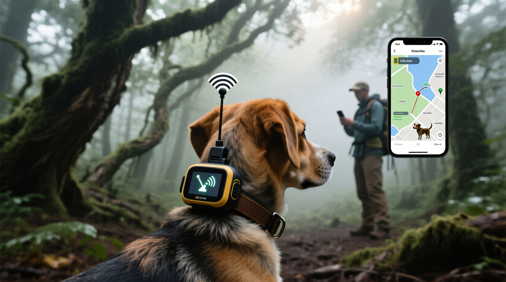
Pet GPS trackers don’t rely solely on GPS satellites. They combine multiple technologies to deliver location data to your smartphone or web dashboard:
- GPS (Global Positioning System): Uses satellite signals to determine the device’s exact coordinates. This part generally works anywhere with sky visibility—even deep in forests—as long as the receiver can lock onto enough satellites.
- GLONASS & Galileo: Complementary global navigation systems from Russia and the EU. Multi-system support improves accuracy and speed in challenging environments.
- Cellular Network (4G/LTE-M/NB-IoT): Transmits the GPS data from the tracker to the cloud using mobile networks. This is the weak link in forests and rural zones where coverage is spotty or nonexistent.
- Wi-Fi & Bluetooth: Used for short-range tracking, usually within urban or home environments. Not effective in wilderness settings.
- Radio Frequency (RF) or LoRaWAN: Some advanced trackers use long-range radio signals to maintain contact over miles without cellular infrastructure.
In cities, all systems typically work in harmony: GPS pinpoints location, and cellular networks relay it instantly. In dense forests, however, the chain often breaks at the transmission stage—not because GPS fails, but because the tracker can’t send the data back to you.
Tip: Look for trackers that support both GPS + GLONASS/Galileo for better satellite acquisition under tree canopy.Performance in Dense Forests: What Real Users Experience
A 2023 field study by the Outdoor Pet Safety Institute tested six popular GPS collars across three forested regions in the Pacific Northwest, Adirondacks, and Appalachian Trail corridors. Researchers released controlled test units up to 2 miles into wooded trails with minimal human presence.
The results were mixed:
- All devices acquired GPS locks within 45–90 seconds when briefly exposed to open sky.
- Under continuous heavy canopy, two budget models failed to establish a fix for over 10 minutes.
- Only one model—the Garmin Delta Smart—maintained consistent updates via its built-in UHF radio backup, even when cellular signal dropped completely.
- Four out of six trackers lost connectivity entirely once outside 3G/4G range, rendering real-time tracking useless despite having valid GPS coordinates stored locally.
“GPS itself isn’t the issue—it’s the last-mile delivery of data. In deep woods, you’re only as connected as your nearest cell tower.” — Dr. Alan Reyes, Senior Researcher at the Outdoor Pet Safety Institute
This highlights a key misconception: just because a device has “GPS” doesn’t mean you’ll see your pet’s location live on a map. Without a transmission method, the data remains trapped on the device until it re-enters service range.
Comparing Tracker Types: Urban vs. Wilderness Performance
| Tracker Type | Best For | Forest Performance | Key Limitation |
|---|---|---|---|
| Cellular-Based (e.g., Whistle, Fi Series 2) | Cities, suburbs, areas with strong LTE coverage | Poor to fair (depends on local signal) | Fails when out of network range |
| Bluetooth Tags (e.g., Tile, AirTag) | Backyard, parks, short-range searches | Very poor (range: ~100 ft) | No GPS; requires nearby phone |
| Hybrid RF + Cellular (e.g., Garmin Delta Smart) | Hiking, hunting, rural areas | Excellent (UHF radio extends range to 4+ miles) | Higher cost; bulkier design |
| Satellite Messengers w/ GPS (e.g., SPOT Gen4 with pet mode) | Extreme backcountry, international travel | Good (uses satellite network) | Delayed updates; subscription required |
| LoRaWAN Trackers (emerging tech) | Private land with gateway access | Fair to good (low-power, long-range) | Limited ecosystem; not widely available |
The table shows a clear divide: consumer-grade trackers designed for urban pets perform poorly off-grid, while specialized devices built for hunters, hikers, or working dogs offer far greater resilience.
Real-World Example: Lost Dog in the Smoky Mountains
In June 2022, Sarah Thompson’s Border Collie, Scout, chased a deer off-trail during a family camping trip in Great Smoky Mountains National Park. Scout wore a standard Fi Series 2 collar.
Initial attempts to locate him via the app showed “Last Known Location” from two hours earlier—near the campsite. Rangers noted that while the GPS had recorded new positions intermittently, the collar couldn’t transmit them due to dead zones along the ridge.
After 36 hours, Scout reappeared near a ranger station where partial 4G coverage existed. The app updated immediately, showing a path that confirmed he’d been moving through valleys invisible to cell towers. Fortunately, he was unharmed.
Sarah later upgraded to a Garmin Alpha 200i, which uses dual-tracking (GPS + tri-band radio). “It’s heavier,” she said, “but now I know I can track him even if we lose cell service. That peace of mind is worth every ounce.”
Maximizing GPS Tracker Effectiveness in Forested Areas
If you frequently venture into wooded or remote areas with your pet, relying on a city-optimized tracker is risky. Here’s how to improve your odds:
- Choose a tracker with offline capabilities: Models that store GPS logs internally can upload data retroactively when back in range, giving you a movement history.
- Opt for hybrid communication: Devices combining cellular with radio frequency (like Garmin or SportDOG) allow direct handheld tracking without any network dependency.
- Check topographic maps of your area: Use apps like Gaia GPS or Google Earth to identify known dead zones. Plan routes accordingly.
- Carry a secondary locator: Attach a small RF beacon or audible tag (like a Rumbler) to increase chances of auditory recovery.
- Enable geofencing alerts: Even if real-time tracking drops, some systems notify you when the pet re-enters a mapped zone with coverage.
Action Checklist: Selecting a Forest-Ready GPS Tracker
- ✅ Supports multi-satellite systems (GPS, GLONASS, Galileo)
- ✅ Offers non-cellular transmission (radio, satellite, or LoRa)
- ✅ Has proven performance in independent field tests
- ✅ Includes breadcrumb trail or offline logging
- ✅ Provides durable, weatherproof build (IP67 or higher)
- ✅ Compatible with handheld receivers or mapping software
- ✅ Comes with a reliable customer support line for emergencies
FAQ: Common Questions About GPS Tracking in Forests
Can GPS trackers work without cell service?
GPS satellites themselves don’t require cell service, so location calculation can still occur. However, transmitting that data to your phone usually does require cellular, Wi-Fi, or an alternative like radio or satellite messaging. Without transmission capability, you won’t receive updates in real time.
Are Apple AirTags useful for finding lost pets in the woods?
Not reliably. AirTags use Bluetooth and depend on iPhones nearby to detect and report their location via Apple’s Find My network. In remote forests with few people, there may be no devices to pick up the signal. Additionally, AirTags lack GPS and cannot provide autonomous location data.
Do GPS collars drain battery faster in forests?
Yes. When under heavy canopy, GPS receivers struggle to maintain satellite lock, causing the device to work harder and consume more power. Combined with repeated failed attempts to connect to cellular networks, this can reduce battery life by 30–50% compared to open environments.
Conclusion: Matching Your Tracker to Your Environment
Pet GPS trackers are powerful tools—but their effectiveness hinges on context. In cities and suburbs with robust infrastructure, most modern devices deliver accurate, real-time location updates with minimal hassle. However, in dense forests, mountainous regions, or rural landscapes, the same models often fall short due to reliance on fragile cellular networks and limited satellite acquisition.
For pet owners who explore beyond paved trails, investing in a rugged, hybrid-capable tracker with radio or satellite backup isn’t just an upgrade—it’s a necessity. These devices close the gap between urban convenience and wilderness reliability, ensuring that when your pet wanders off, you’re not left blind.
Technology continues to evolve, with emerging solutions like low-orbit satellite integration and mesh-network pet tags on the horizon. Until then, choose wisely based on where you actually use the device—not just where it promises to work.
🚀 Take action today: Review your current pet tracker’s specs. If you hike, camp, or live near wildland areas, consider upgrading to a model designed for off-grid resilience. Your pet’s safety depends on it.