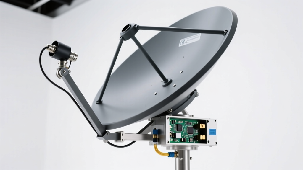
Types of GNSS & GPS Antennas: A Comprehensive Guide
GNSS (Global Navigation Satellite System) and GPS antennas are critical components in modern positioning, navigation, and timing (PNT) systems. These antennas receive microwave signals from satellites orbiting the Earth, enabling receivers to calculate precise geographic locations. With the evolution of satellite technology, multiple frequency bands—such as L1, L2, and L5—have been introduced to enhance accuracy, reliability, and performance across diverse environments.
Different GNSS antennas are optimized for specific use cases, ranging from consumer navigation to high-precision surveying and aviation safety. Dual- and multi-frequency antennas that support combinations of L1, L2, and L5 signals are increasingly popular because they mitigate atmospheric errors and improve signal integrity in urban canyons, dense foliage, and other challenging conditions.
GNSS L1 Antenna
Operates at 1575.42 MHz, the primary civilian frequency used by GPS and other global systems like Galileo, GLONASS, and BeiDou.
Advantages
- Widely supported across all major satellite constellations
- Standard in most consumer devices (smartphones, car navigation, wearables)
- Provides sufficient accuracy for everyday navigation (3–5 meter precision)
- Cost-effective and readily available
Limitations
- Vulnerable to multipath interference (e.g., reflections from buildings)
- Affected by ionospheric delays, reducing long-baseline accuracy
- Lower signal-to-noise ratio in obstructed environments
Best for: Consumer electronics, vehicle tracking, basic telematics, and general navigation
GNSS L2 Antenna
Receives signals at 1227.60 MHz, originally reserved for military use but now accessible for civilian high-precision applications.
Advantages
- Enables dual-frequency correction to eliminate ionospheric delay errors
- Significantly improves positional accuracy (down to centimeter-level with RTK)
- Essential for geodetic surveying, precision agriculture, and drone navigation
- Stronger performance in moderate signal obstruction
Limitations
- Higher cost compared to single L1 antennas
- Requires compatible multi-band receivers
- Not necessary for basic location services
Best for: Surveying, construction, scientific research, and professional-grade GNSS applications
GNSS L5 Antenna
Designed for the 1176.45 MHz frequency, L5 is a newer, safety-critical signal developed for aviation and life-sensitive applications.
Advantages
- Higher transmission power and wider bandwidth for improved signal robustness
- Advanced modulation resists interference and jamming
- Excellent performance in urban canyons and under tree canopy
- Supports real-time, high-integrity navigation for autonomous systems
Limitations
- Limited satellite availability (still in global deployment phase)
- Requires newer hardware and firmware support
- Premium pricing due to advanced design and niche applications
Best for: Aviation, emergency response, autonomous vehicles, and intelligent transportation systems (ITS)
Dual/Multi-Frequency Antennas
Capable of receiving L1 + L2, L1 + L5, or all three bands simultaneously for maximum accuracy and reliability.
Advantages
- Combines strengths of multiple frequencies for superior performance
- Enables real-time kinematic (RTK) and PPP (Precise Point Positioning)
- Minimizes errors from atmosphere, multipath, and signal blockage
- Future-proof investment for evolving GNSS infrastructure
Limitations
- Higher cost and complexity
- Larger form factor and power requirements
- Overkill for basic navigation needs
Best for: High-precision mapping, UAVs, autonomous machinery, and mission-critical operations
| Antenna Type | Frequency | Accuracy | Primary Use Case | Signal Robustness |
|---|---|---|---|---|
| GNSS L1 | 1575.42 MHz | 3–5 meters | Consumer navigation, basic tracking | Moderate |
| GNSS L2 | 1227.60 MHz | Centimeter-level (with correction) | Surveying, precision agriculture | High |
| GNSS L5 | 1176.45 MHz | Sub-meter to meter-level | Aviation, public safety, ITS | Very High |
| Dual/Multi-Frequency | L1 + L2 + L5 | Centimeter to sub-meter | Professional, autonomous, RTK | Exceptional |
Expert Tip: For applications requiring high accuracy, always pair a multi-frequency GNSS antenna with a receiver that supports RTK (Real-Time Kinematic) or PPP corrections. This combination can reduce positioning errors from meters to centimeters, especially in open-sky environments.
Choosing the Right GNSS Antenna
Selecting the appropriate GNSS antenna depends on your application’s accuracy, reliability, and environmental demands:
- For everyday use: An L1 antenna is sufficient and cost-effective.
- For professional surveying: Choose L2 or dual-frequency (L1/L2) antennas with correction services.
- For safety-critical systems: Prioritize L5-enabled antennas for enhanced signal integrity.
- For future-proofing: Invest in multi-frequency antennas that support L1, L2, and L5 bands.
As global satellite coverage expands and new signals become fully operational, multi-band GNSS technology will continue to drive innovation in navigation, automation, and smart infrastructure.
How To Choose The Right GNSS GPS Antenna
Selecting the appropriate GNSS (Global Navigation Satellite System) GPS antenna is crucial for achieving accurate, reliable, and consistent positioning across a wide range of applications—from consumer navigation to precision agriculture, aviation, and geospatial surveying. The right antenna enhances signal reception, improves positional accuracy, and ensures long-term durability under real-world conditions.
This guide outlines the key factors to consider when choosing a GNSS GPS antenna, helping you make an informed decision based on your specific operational needs and environmental challenges.
1. Application Requirements
The intended use of the GNSS system is the most critical factor in selecting the right antenna. Different applications demand varying levels of accuracy, signal robustness, and frequency support.
L1-Only Antennas
Ideal for basic navigation tasks such as vehicle tracking, consumer-grade GPS devices, and mobile applications. These antennas receive signals on the L1 frequency (1575.42 MHz) from GPS satellites and offer adequate accuracy (typically 3–5 meters).
They are cost-effective and widely used in non-critical applications where high precision is not required.
Dual-Frequency (L1/L2) Antennas
Essential for high-precision applications like land surveying, construction layout, and GIS data collection. By receiving both L1 and L2 (1227.60 MHz) signals, these antennas can correct ionospheric delays, significantly improving accuracy to within centimeters when used with RTK (Real-Time Kinematic) or PPP (Precise Point Positioning) techniques.
L5-Enhanced Antennas
Designed for safety-critical systems such as aviation, autonomous vehicles, and emergency response networks. The L5 frequency (1176.45 MHz) offers higher bandwidth, improved signal structure, and better resistance to interference and multipath errors.
L5 signals are more robust and provide faster acquisition times, making them ideal for environments where signal integrity is paramount.
2. Signal Reception and Sensitivity
Signal performance depends heavily on the operating environment. Urban canyons, dense foliage, mountainous terrain, and indoor or semi-enclosed spaces can degrade GNSS signal quality through multipath reflection, signal blockage, or atmospheric interference.
3. Size and Form Factor
The physical design of the antenna must align with the installation platform and spatial constraints.
Compact Antennas
Suitable for drones, handheld devices, wearables, and compact IoT trackers. These often use patch or chip antennas and prioritize minimal footprint over peak performance.
While convenient, they may sacrifice some gain and multipath rejection capabilities.
High-Performance Antennas
Larger antennas, such as quadrifilar helix or choke ring designs, offer superior phase center stability, excellent multipath rejection, and wider sky view coverage.
Commonly used in base stations, survey equipment, and scientific applications where precision is critical.
Ensure the antenna’s mounting style (magnetic, threaded, adhesive, or panel-mount) matches your deployment requirements.
4. Compatibility With GNSS Systems
Modern GNSS antennas should support multiple global constellations to maximize satellite visibility and improve positional accuracy, especially in obstructed environments.
| GNSS System | Region Coverage | Key Benefits |
|---|---|---|
| GPS (USA) | Global | Widely supported, stable signals, excellent baseline accuracy |
| GLONASS (Russia) | Global | Improves satellite count, especially at high latitudes |
| Galileo (EU) | Global | High accuracy, encrypted signals for commercial use |
| BeiDou (China) | Asia-Pacific (global by BeiDou-3) | Critical for operations in China and surrounding regions |
Choose a multi-GNSS antenna that supports all relevant systems in your region. This ensures faster time-to-first-fix (TTFF), improved accuracy, and greater reliability in dynamic or obstructed environments.
5. Durability and Environmental Conditions
The antenna must withstand the environmental conditions of its installation site to ensure long-term reliability.
Proper sealing and ruggedized construction prevent moisture ingress and internal component failure, reducing maintenance costs and downtime.
Important: Always verify antenna compatibility with your GNSS receiver. Mismatched impedance (typically 50 ohms), incorrect connectors (e.g., SMA, TNC, MCX), or unsupported frequency bands can lead to poor performance or complete signal loss. Consult manufacturer datasheets and test the antenna in real-world conditions before full-scale deployment.
Commercial Uses of GNSS/GPS Antennas
Global Navigation Satellite System (GNSS) and GPS antennas are essential components in a wide range of commercial industries, enabling precise positioning, navigation, and timing (PNT) capabilities. These antennas receive signals from satellite constellations such as GPS (USA), GLONASS (Russia), Galileo (EU), and BeiDou (China), delivering accurate location data critical for operational efficiency, safety, and automation. Below is a detailed overview of key commercial applications where GNSS/GPS antennas play a transformative role.
Fleet Management and Transportation
GNSS antennas are the backbone of modern fleet management systems, providing real-time vehicle tracking and operational insights. By integrating with telematics platforms, they allow companies to monitor location, speed, route adherence, fuel consumption, and driver behavior across entire fleets.
- Enables dynamic route optimization to reduce fuel costs and delivery times
- Supports compliance with regulatory requirements (e.g., ELD mandates)
- Improves customer service through accurate arrival time predictions
- Enhances driver safety with geofencing and emergency alerts
- Facilitates predictive maintenance by tracking vehicle usage patterns
Industry Insight: Logistics and ride-sharing companies invest in high-gain, multi-band GNSS antennas to ensure signal reliability in urban canyons and under adverse weather conditions.
Agriculture – Precision Farming
In modern agriculture, GNSS antennas power precision farming technologies that maximize yield while minimizing resource waste. They enable automated steering systems, variable rate application (VRA), and field mapping with centimeter-level accuracy.
- Guides autonomous tractors and harvesters along optimal paths, reducing overlap
- Supports soil sampling and yield monitoring using GIS-integrated data
- Enables efficient use of water, fertilizers, and pesticides based on precise field zoning
- Tracks equipment movement to optimize labor and machinery deployment
- Integrates with farm management software for data-driven decision-making
Pro Tip: Farmers increasingly adopt RTK (Real-Time Kinematic) GNSS systems with dual-frequency antennas for sub-inch accuracy in planting and spraying operations.
Construction and Earthworks
GNSS antennas are revolutionizing construction by enabling machine control and site positioning without traditional surveying methods. They are used in bulldozers, excavators, graders, and compactors to achieve precise grading and excavation.
- Reduces reliance on manual survey crews, saving time and labor costs
- Enables 3D machine guidance for accurate grading to design specifications
- Supports drone-based topographic surveys for pre- and post-construction analysis
- Allows real-time progress tracking against digital project models (BIM integration)
- Improves safety by minimizing worker presence in hazardous zones
Technical Note: Construction-grade GNSS antennas often feature ruggedized enclosures and enhanced multipath rejection for reliable performance in complex environments.
Aviation
GNSS antennas are integral to modern aviation navigation, supporting en-route guidance, approach procedures, and even precision landings. They enhance situational awareness and reduce dependency on ground-based navigation aids.
- Enables Performance-Based Navigation (PBN) and Required Navigation Performance (RNP) approaches
- Supports ADS-B (Automatic Dependent Surveillance-Broadcast) for real-time aircraft tracking
- Improves flight efficiency with optimized routing and reduced separation minima
- Enhances safety in low-visibility conditions through LPV (Localizer Performance with Vertical guidance)
- Reduces infrastructure costs by minimizing need for ILS and VOR ground stations
Critical Upgrade: Modern aircraft are adopting L5-band capable GNSS antennas for improved signal integrity and resistance to interference during critical phases of flight.
Mapping and Surveying
GNSS antennas are indispensable tools for geospatial professionals, delivering high-precision positioning for land surveys, cartography, and infrastructure planning. With advancements in technology, accuracy has improved from meter-level to centimeter- or even millimeter-level precision.
- Enables rapid data collection for topographic and cadastral surveys
- Supports aerial and drone-based photogrammetry with precise geotagging
- Integrates with GIS platforms for spatial data management and analysis
- Facilitates monitoring of structural deformations (e.g., bridges, dams) over time
- Used in boundary determination, pipeline routing, and environmental assessments
Best Practice: Surveying firms utilize dual-frequency, multi-constellation GNSS antennas with RTK or PPK (Post-Processed Kinematic) capabilities to achieve the highest accuracy and reliability.
Expert Recommendation: When selecting GNSS antennas for commercial use, consider factors such as frequency band support (L1, L2, L5), gain pattern, multipath resistance, environmental durability, and compatibility with correction services (e.g., SBAS, RTK networks). Investing in professional-grade antennas ensures long-term reliability, accuracy, and return on investment across demanding operational environments.
| Industry | Primary Use Case | Antenna Type | Accuracy Requirement |
|---|---|---|---|
| Fleet Management | Vehicle Tracking & Route Optimization | Single-band, High-Gain | 3–5 meters |
| Agriculture | Autonomous Guidance & VRA | Dual-Frequency, RTK-Capable | Sub-10 cm |
| Construction | Machine Control & Grade Guidance | Ruggedized Multi-Band | 1–3 cm + RTK |
| Aviation | Navigation & Landing Assistance | L5-Enabled, Certified | Better than 3 meters (SBAS) |
| Surveying | Topographic & Cadastral Mapping | Dual-Frequency, Multi-Constellation | 1–2 cm (RTK/PPK) |
Additional Considerations Across Industries
- Signal Integrity: Antennas with advanced filtering reduce interference from nearby electronics and improve signal lock in challenging environments
- Environmental Durability: IP67-rated or higher enclosures protect against dust, moisture, and vibration in harsh conditions
- Integration Capability: Compatibility with existing control systems (CAN bus, NMEA 2000, etc.) ensures seamless deployment
- Correction Services: Access to augmentation systems (WAAS, EGNOS, CORS) enhances positional accuracy without additional hardware
- Future-Proofing: Multi-constellation support (GPS + Galileo + GLONASS + BeiDou) ensures resilience and availability in all regions
GNSS Technology FAQ: Understanding L1, L2, L5 Signals, Accuracy, and RTK
Global Navigation Satellite Systems (GNSS) are essential for precise positioning across industries such as surveying, agriculture, aviation, and transportation. This comprehensive Q&A guide explores key aspects of GNSS technology, including signal frequencies, accuracy factors, environmental impacts, and advanced correction methods like RTK. Whether you're a field technician, engineer, or enthusiast, understanding these fundamentals will help you optimize GNSS performance in real-world applications.
Quick Insight: Modern multi-frequency GNSS receivers can leverage L1, L2, and L5 signals simultaneously to achieve higher accuracy and reliability by correcting atmospheric delays and reducing multipath errors.
What is the difference between the GNSS L1, L2, and L5 signals?
The GNSS L1, L2, and L5 signals operate on different frequencies and serve distinct purposes based on their design, availability, and application requirements. These signals are transmitted by satellites in systems like GPS, GLONASS, Galileo, and BeiDou, enabling receivers to calculate position, velocity, and time with varying degrees of precision.
- L1 Signal (1575.42 MHz): The most widely used civilian frequency, L1 carries the C/A (Coarse/Acquisition) code used in standard GPS positioning. It is accessible to nearly all consumer-grade devices, including smartphones and vehicle navigation systems. While it provides adequate accuracy for general use, it is more susceptible to ionospheric interference.
- L2 Signal (1227.60 MHz): Originally reserved for military applications, L2 is now also available for civilian use through modernized GPS satellites (L2C signal). It plays a crucial role in dual-frequency receivers, allowing correction of ionospheric delay errors when combined with L1. This makes L2 particularly valuable for high-precision applications such as geodetic surveying and scientific research.
- L5 Signal (1176.45 MHz): Designed specifically for safety-of-life applications, L5 operates in a protected aeronautical navigation band. It offers higher power, greater bandwidth, and improved signal structure, making it more robust against interference and multipath. L5 is ideal for aviation, autonomous vehicles, and other mission-critical systems where reliability and accuracy are paramount.
By combining data from multiple frequencies, advanced GNSS receivers can significantly reduce positioning errors caused by atmospheric conditions, resulting in sub-meter to centimeter-level accuracy depending on the correction method used.
| Signal | Frequency | Primary Use | Key Advantages | Receiver Compatibility |
|---|---|---|---|---|
| L1 | 1575.42 MHz | Civilian navigation (smartphones, car GPS) | Widely available, low-cost reception | All GNSS receivers |
| L2 | 1227.60 MHz | Military & high-precision civilian (surveying) | Ionospheric error correction, dual-frequency capability | High-end and dual-frequency receivers |
| L5 | 1176.45 MHz | Safety-critical applications (aviation, autonomous systems) | High power, resistance to interference, better multipath rejection | Newer multi-band GNSS receivers |
Which factors influence the accuracy of a GNSS antenna?
GNSS antenna accuracy is influenced by a combination of geometric, atmospheric, and hardware-related factors. Understanding these elements helps in selecting the right equipment and optimizing deployment conditions for reliable positioning.
- Satellite Geometry (DOP – Dilution of Precision): The spatial arrangement of visible satellites affects how accurately a receiver can triangulate its position. Good geometry (satellites spread across the sky) results in low DOP values and higher accuracy, while poor geometry (satellites clustered together) increases uncertainty.
- Number of Visible Satellites: More satellites improve position solution reliability and accuracy. Obstructions like buildings or terrain can block signals, reducing the number of usable satellites and increasing error margins.
- Atmospheric Conditions: The ionosphere and troposphere delay GNSS signals, introducing timing errors. These effects vary with time of day, solar activity, and weather. Multi-frequency antennas mitigate this by comparing signal delays across frequencies (e.g., L1 vs L2) to estimate and correct ionospheric errors.
- Receiver Quality and Antenna Design: High-quality antennas with good phase center stability, ground planes, and filtering capabilities reduce noise and multipath. Receiver algorithms also play a critical role in processing signals and applying corrections.
- Signal Interference: Electromagnetic interference from nearby transmitters or intentional jamming can degrade or block GNSS signals, affecting accuracy and availability.
Using multi-frequency, multi-constellation receivers (supporting GPS, GLONASS, Galileo, BeiDou) enhances accuracy by increasing satellite visibility and enabling robust error correction.
Expert Tip: For maximum accuracy, use a geodetic-grade antenna with a ground plane and ensure firmware supports all available satellite systems and frequencies (L1, L2, L5).
How do environmental factors affect GNSS antenna performance?
Environmental conditions significantly impact GNSS signal reception and overall system performance. Even with advanced hardware, physical surroundings can introduce challenges that degrade positioning accuracy.
- Signal Obstruction: Tall buildings, dense tree canopies, tunnels, and mountainous terrain can block direct line-of-sight to satellites, reducing the number of usable signals and weakening signal strength.
- Multipath Errors: In urban environments or near reflective surfaces (glass, metal, water), GNSS signals bounce before reaching the antenna. These delayed, reflected signals interfere with direct signals, causing position inaccuracies. This is especially problematic in cities with "urban canyons."
- Foliage Attenuation: Thick vegetation absorbs and scatters GNSS signals, particularly at higher frequencies like L5. This reduces signal-to-noise ratio and can lead to loss of lock on satellites.
- Weather and Atmospheric Effects: While rain and clouds have minimal impact on GNSS signals, severe ionospheric disturbances (e.g., solar storms) can cause signal scintillation and increased positioning errors.
To combat these issues, specialized antennas with advanced filtering, choke rings, or multi-path mitigation technologies are used in challenging environments. Proper antenna placement—away from reflective surfaces and obstructions—is equally important for maintaining signal integrity.
Warning: Always mount GNSS antennas in clear, unobstructed locations with a full view of the sky. Avoid placing them near metal structures, rooftop equipment, or inside enclosures that may block or reflect signals.
What is the role of RTK in improving GNSS accuracy?
RTK (Real-Time Kinematic) positioning is a powerful technique that dramatically improves GNSS accuracy by using carrier-phase measurements and real-time correction data from a fixed base station. It is widely adopted in applications requiring centimeter-level precision.
- Base Station and Rover Setup: A stationary GNSS receiver (base station) collects data from satellites and calculates correction messages based on its known precise location. These corrections are transmitted in real time (via radio or cellular networks) to a mobile receiver (rover).
- Error Correction: RTK corrects common errors such as ionospheric delay, satellite orbit inaccuracies, and clock drift by comparing measurements between the base and rover. This enables the rover to achieve centimeter-level accuracy (typically 1–2 cm + 1 ppm).
- Applications: RTK is essential in precision agriculture (auto-guidance systems), land surveying, construction machine control, drone navigation, and autonomous vehicle development.
- Network RTK (NRTK): Instead of a single base station, networks of reference stations provide enhanced coverage and accuracy over large regions through services like VRS (Virtual Reference Station).
RTK requires a stable communication link between base and rover and performs best within 10–20 km of the base station. When combined with multi-frequency GNSS receivers, RTK delivers highly reliable, real-time positioning under favorable conditions.
Pro Tip: For long-term monitoring or surveying projects, consider using PPP (Precise Point Positioning) as an alternative to RTK when a base station isn’t feasible. While slower to converge, PPP uses global correction data and works anywhere with satellite coverage.
Additional Recommendations for Optimal GNSS Performance
- Use multi-frequency, multi-constellation GNSS receivers to maximize satellite availability and accuracy.
- Regularly update firmware to support new signals (e.g., L5) and improve algorithm performance.
- Perform site surveys to identify potential signal obstructions or sources of interference before installing permanent antennas.
- Use high-quality coaxial cables and connectors to minimize signal loss between antenna and receiver.
- Monitor satellite health and constellation status using tools like GNSS planning software or online dashboards.
- Consider integrating inertial navigation systems (INS) with GNSS for improved performance in signal-denied environments.
Understanding the interplay between GNSS signals, environmental conditions, and correction technologies empowers users to make informed decisions about equipment selection and deployment strategies. As GNSS continues to evolve with new frequencies and enhanced capabilities, staying informed ensures you can leverage the full potential of this transformative technology.